

Wanderkarten mit Tourenvorschlägen Kümmerly+Frey
Switzerland, National Park, No. 16, hiking tour map 1:50,000

Article Number: 978-3-8283-0974-6
Scale: 1:50 000
This product is in stock.
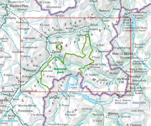
In the Kümmerly+Frey hiking tour map National Park at a scale of 1:50,000, the most beautiful hiking routes in the region have been compiled for you.
Thanks to the clearly marked, easy-to-read, and up-to-date hiking trails, the tidy map layout, and the clear terrain representation, this map is the perfect tool to make the most of your visit to this exceptional region. With the hiking route suggestions marked on the map, you'll easily find an adventure in your area.
The map includes detailed topographical information, such as contour lines and elevation data for mountain peaks, passes, and major lakes, providing an accurate representation of the terrain. In collaboration with Outdooractive, we have included all the essential information about the proposed routes: elevation profiles, hiking time estimates, restaurants, post bus stops, and much more!
The folded map for hikers is made from durable, largely water-resistant, and tear-resistant paper. Even in challenging weather conditions, it won't let you down.
If the GPS stops working or your phone runs out of battery, the clearly marked hiking trails, viewpoints, train stations, dining options, campsites, parking areas, etc., on the map will always help you stay oriented.
- Free shipping in Switzerland for 2 items*
- 20% discount for 3 items
* Except for bulky good deliveries (posters)
Digital maps

PLAN, DISCOVER, EXPERIENCE - on the web and mobile!
Download our HKF Outdoor App!
Navigator

More than 1000 Web-Sites in 47 countries! Listing of important European Web-Sites supporting your planning and booking of journeys.