

Velokarten Schweiz Kümmerly+Frey
Switzerland, Basel, Basel-Landschaft, No. 4, cycling map 1:60'000

Article Number: 978-3-259-02404-1
Scale: 1:60 000
This product is in stock.
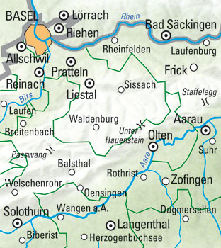
On the Kümmerly+Frey Basel cycling map at a 1:60,000 scale, you’ll find everything you need for orientation and inspiration.
The map covers the key areas of interest, from Basel to Langenthal.
With clearly marked cantonal and national cycling routes (Veloland Switzerland), up-to-date and easy-to-read mountain bike trails, a clean and structured map layout, a clear terrain representation, and the option to download the map via the HKF Outdoor app, this map is the perfect tool to make the most of your visit to this exceptional region. Indications of gradients, slopes, and warnings for difficult sections help you prepare for your custom route.
The map also highlights bike-friendly accommodations, making it easier to plan multi-day tours. Additionally, marked chairlifts, cable cars, and boat loading stations can be of great help.
It provides detailed topographic information, including contour lines and elevation markers for mountain peaks, passes, and major lakes, giving cyclists a realistic impression of the landscape.
This folding cycling map is made of durable, water-resistant, and tear-resistant paper, ensuring reliability even in challenging weather conditions.
If your GPS fails or your phone runs out of battery, the clearly marked cycling routes with distance indicators (in km), route numbers, viewpoints, train stations, picnic areas, and restaurants will always help you find your way.
- Free shipping in Switzerland for 2 items*
- 20% discount for 3 items
* Except for bulky good deliveries (posters)
Digital maps

PLAN, DISCOVER, EXPERIENCE - on the web and mobile!
Download our HKF Outdoor App!
Navigator

More than 1000 Web-Sites in 47 countries! Listing of important European Web-Sites supporting your planning and booking of journeys.